Europe provides many beautiful hiking trails that are worth putting on your hiking shoes and getting to know them. As all of us have a different health condition, that is why we prepared tips for day trips, as well as routes that you could conquer for several days.
Distance: 6,2 miles
Difficulty: easy
Duration: 3 - 4 hours
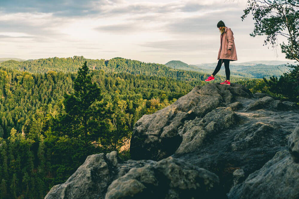
You can enjoy the most popular hike in the Dolomites, even if your fitness level is not the best one. Of course, there are several routes around Tre Cime and many of them are suitable for experienced hikers only.
The ascend of this hike is not difficult and kids can easily manage it as well, therefore it's a very popular hiking route in Europe. It starts in Rifugio Auronzo, continues through Rifugio Lavaredo and Rifugio Locatelli, from where you can enjoy beautiful views if you are lucky with the weather. Continue through Tre Cime valley and return to Rifugio Auronzo.
Distance: 2,2 – 11,2 miles
Difficulty: easy - moderate
Duration: 3 to 8 hours
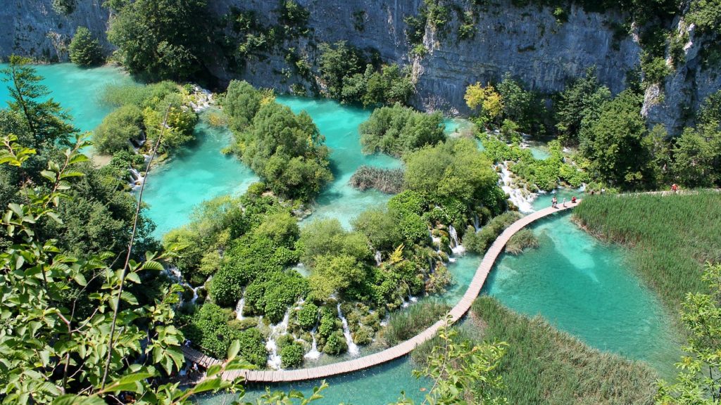
Beautiful Croatia is known mostly for its coastline, but Plitvice Lakes are among the most visited places in this country and also in Europe. No wonder, cascades, and lakes in 2017 welcomed more than 1.7 million visitors.
Several hiking trails are available, varying in difficulty and length. The shortest circuit is 2.2 miles and takes about 3 hours. The longest circuit is 11.2 miles and depending on your health condition, it could take from 6 to 8 hours.
Distance: 7,5 miles
Difficulty: difficult
Duration: 6 - 8 hours
Norwegian nature is charming and Kjeragbolten is definitely one of the most beautiful hikes you can do in Europe. Even though the elevation is not so dramatic, it is a more strenuous hike, as you will use chains to get through some parts of it. It is really worth as the views you get are breathtaking. At the top, you can stand on the famous rock, wedged between two cliffs.
Distance: 5 miles
Difficulty: easy
Duration: 3 hours
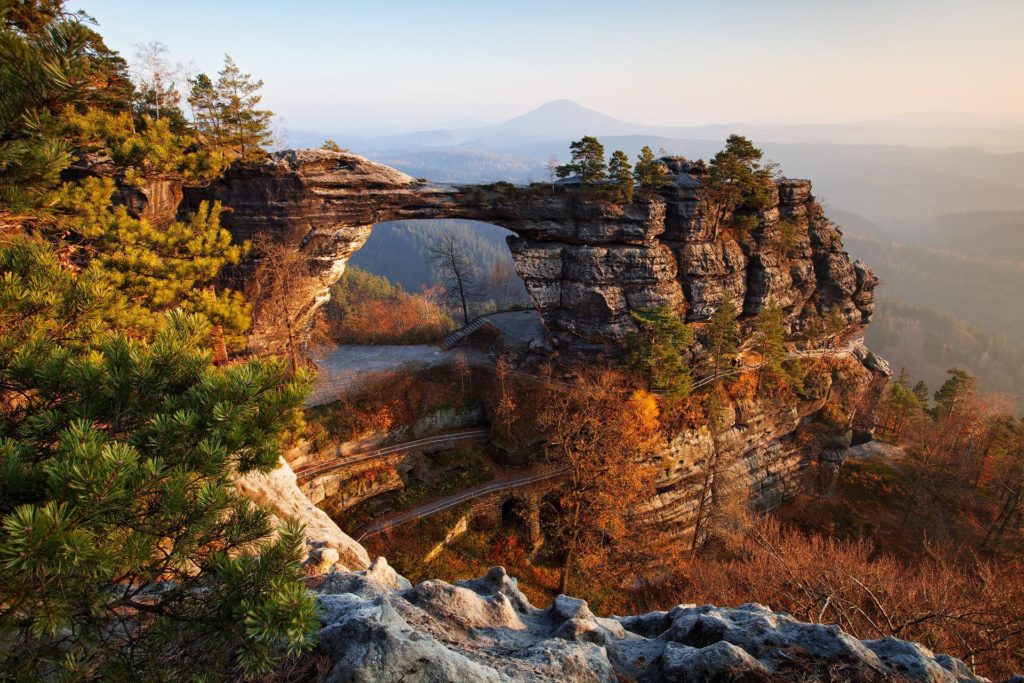
National Park of Bohemian Switzerland, which extends in the northwestern part of the Czech Republic and extends to neighboring Germany, hides a few unique areas within its smaller acreage. The first to mention is the largest sandstone bridge in Central Europe - Pravčická brána. Rock bridge has large dimensions: 16 m (52 feet) high, 8 m (26 feet) wide and 26 m (85 feet) wide span.
If you are in the mood for more extended hiking, Bohemian Switzerland is full of shorter and longer hiking trails leading through dense forests, cliffs and you will enjoy not only peaceful but also stunning views. The national park is open for public all year round, and it gives you a completely different experience if you visit in April or in October.
Let us show you the beauties of Bohemian Switzerland national park.
Book one of our guided tours and explore Pravčická Gate and other landmarks.
Distance: 17,4 miles
Difficulty: difficult
Duration: 10 - 12 hours
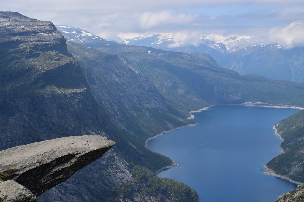
A challenging hike with an elevation of almost 3,000 feet is not suitable for beginners. Even the best hikers need about 10 hours to complete this hike.
The journey itself to the “Troll’s Tongue”, which is a translation of the name from Norwegian into English, will be an experience. You can observe how the mountain glaciers formed the landscape, check the Ringedal dam and the Ringedalsvatnet lake, above which is Trolltunga cliff located, in the height of 3610 ft.
Distance: 7,7 miles
Difficulty: difficult
Duration: 6 - 7 hours
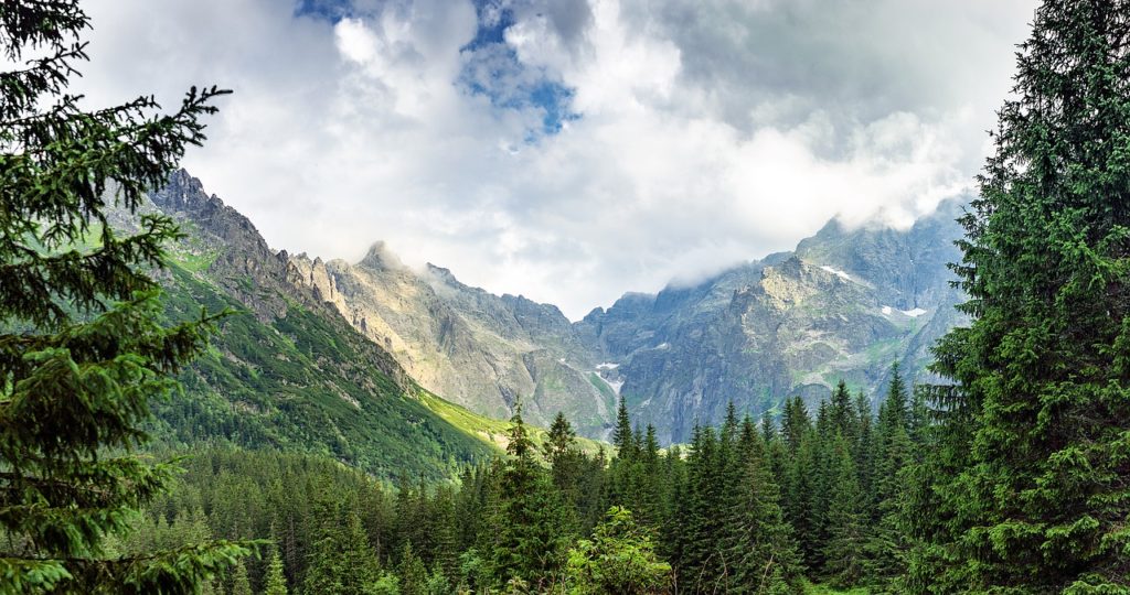
To reach the highest peak of Poland, there is an option of challenging climb through stony terrain and altitude more than 3,600 ft. The route from Lake Morskie Oko is the fastest and leads along the red trail around Lake Czarny Staw with turquoise water. The simpler sections will gradually turn into a steep climb, which you have to go through up to the very top of Rysy. Along the way, you will enjoy beautiful views of the surrounding valleys, meadows and, of course, the clear waters of the Morskie Oko and Czarny Staw lakes.
Rysy is a popular destination to visit also from the Slovak side of the High Tatras. However, the hike from Popradské pleso is slightly longer, but with a less elevation.
Distance: 110 miles
Difficulty: moderate - difficult
Duration: 11 days
Where to sleep: Mountain Huts, Hotels, Hostels, Luxury Ski Resorts
A hiking paradise that satisfies even the most experienced hikers and often is the highlight of alpine hikes. It leads you from Chamonix in France via Les Contamines, Courmayeur in Italy or La Fouly in Switzerland and back to Chamonix. Along the way, you enjoy stunning views of Mont Blanc, the highest alpine mountain.
You can totally customize the excellent adventure around the Western Alps as per your needs, but it is recommended to take it counter-clockwise.
Distance: 100 miles
Difficulty: easy - moderate
Duration: 5 - 7 days
Where to sleep: Campsites, Hostels, Bed & Breakfast
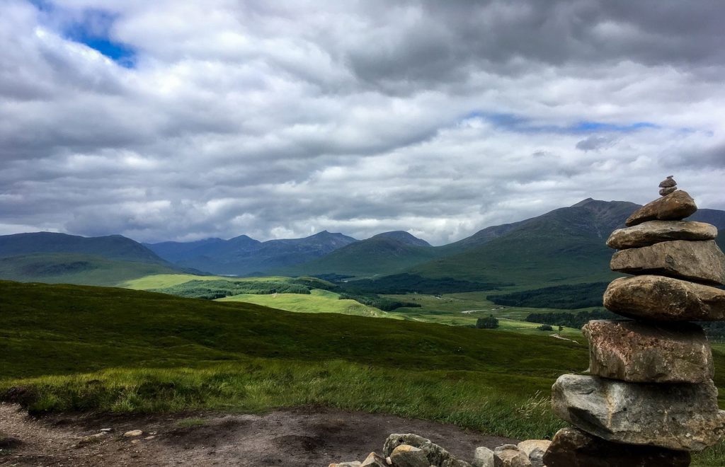
The trail covers Scottish Highlands and connects Milngavie and Fort William. Along the way, you will enjoy the typical Scottish nature - lakes, valleys formed by the surrounding hills or dense forests. We recommend checking more information before the trip about the exact places you visit because some of the crucial moments of history took place along the way.
At the end of the trek, you will ride a historic steam train, which also starred in the Harry Potter movies and is well known as Hogwarts Express.
You can customize your stops according to your physical fitness level and the number of days you have available. Some places have a limited number of beds. Therefore it is good to check in advance the possibility of accommodation and adapt your itinerary.
Distance: 112 miles
Difficulty: difficult
Duration: 14 days
Where to sleep: Shelter huts, Hostels, Huts
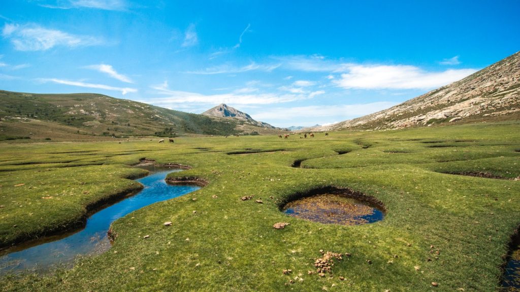
Be ready to have your fitness condition adequately checked. The GR20 is considered to be one of the most challenging hikes in Europe. The only mountain range extends through Corsica from north to south. The difficult route starts in the north of the island in Calenzana and ends in Conza.
Vizzavona is considered a dividing point, so if you do not dare to conquer the whole mountain range, the trek is split into the northern part from Calenzano to Vizzavona and the southern part from Vizzavona to Conza.
The good news is that the most challenging part is right at the beginning of the trek, when you have enough strength and the more you cross the island towards the south, the easier it becomes.
Distance: 34 miles
Difficulty: moderate - difficult
Duration: 4 - 5 days
Where to sleep: Camping, Huts
Iceland's nature is a unique experience for hikers, so we had to put it on our list. This trail starts in Landmannalauger and ends in Þórsmörk, where the Eyjafjallajökull volcano is located. You probably remember its eruption in 2010 and following air traffic problems. The trail is divided into several shorter tours, a daily walk of 7 - 9 miles.
Along the way, you will see the colorful mountains associated with the Landmannalauger, the hot springs, the glaciers and the valleys they formed and gradually descend from the mountainous inland part of Iceland to the greener part of the south coast. The best season for hiking this trail is between mid-June until mid-September, but weather conditions may change unexpectedly.
Distance: 50 - 80 miles
Difficulty: moderate - difficult
Duration: difficult
Where to sleep: Camping, Huts, Hostels
The Romanian part of the Carpathians offers a combination of beautiful mountain hikes during which you can stop in medieval towns, admire fortresses, castles, and chateaux.
Fagaras Mountains or Retezat National Park full of lakes are famous, especially among tourists. The highlight is the Bran Castle, which is well known due to the legend of Dracula.
Distance: 310 miles
Difficulty: moderate - difficult
Duration: 28 days (can be done in parts)
Where to sleep: Camping, Huts, Hostels
Slovenia is one of the best European destinations for hikers, that is for sure. Slovenian Mountain Trail was opened in 1953 and is the oldest connecting trail in the world. In Slovenia there is the longest trail, starting in Maribor, heading south to the Adriatic Sea. It passes through the Kamnik-Savinja Alps and the Julian Alps, on the way you will see the traditional architecture, beautiful valleys and you get the option to conquer several peaks of two thousand meters.
Among them is located the highest mountain and the symbol of Slovenia, which is also displayed on the flag - Triglav with an altitude of 9396 feet.

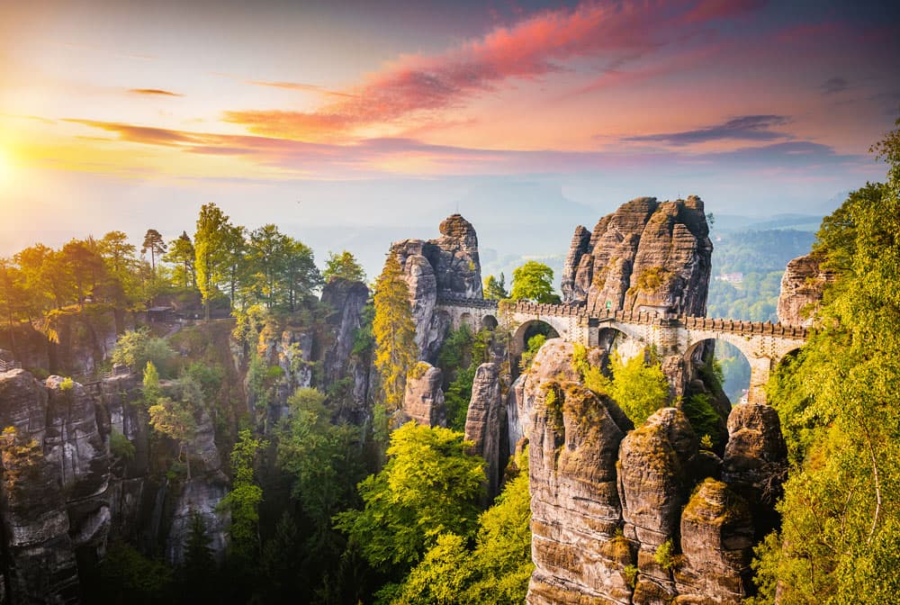
The best choice for an active tour that will take you to the 3 ultimate highlights of the area: Pravcicka Gate stone arch, a boat ride in Gorges and the Bastei Bridge.
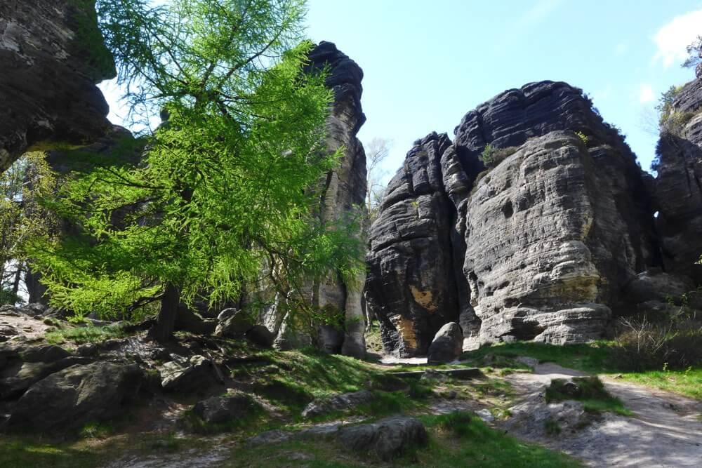
The best choice for an active tour that will take you to the 3 ultimate highlights of the area: Pravcicka Gate stone arch, a boat ride in Gorges and the Bastei Bridge.
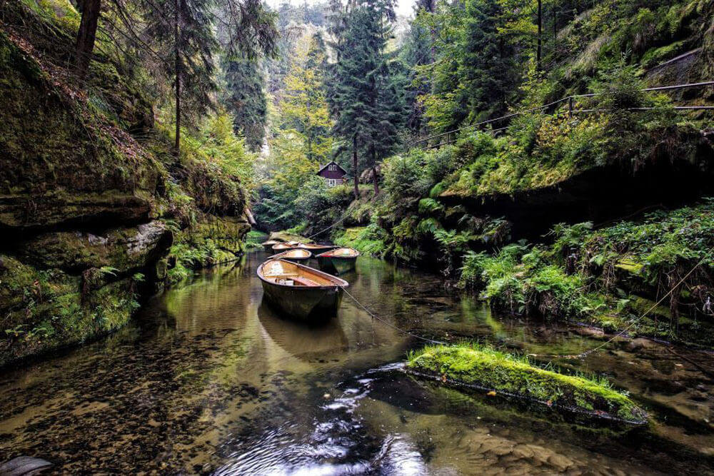
The best choice for an active tour that will take you to the 3 ultimate highlights of the area: Pravcicka Gate stone arch, a boat ride in Gorges and the Bastei Bridge.